
Hydrographic surveying is the science of measuring and describing the physical features of the bottom of a water body, including the depth, shape, and composition of the seabed. The purpose of hydrographic surveying is to provide a detailed understanding of the underwater environ...
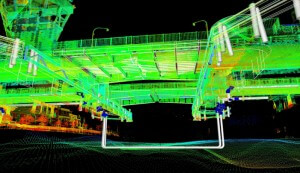
Recent developments in Mobile Laser Scanning (MLS) technology now provide the ability to collect vast amounts of accurate data in situations that may have been impossible or dangerous in the past. MLS systems can now be employed on cars to capture road information at high speed...
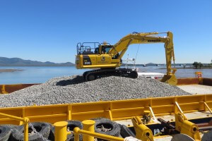
Rock Backfilling of two Liquid Natural Gas (LNG) pipe lines. The Task Astute Surveying were requisitioned to compose a procedure to position a 180 foot barge which employed 3 hoppers placing two layers of rock over two gas pipe lines approximately two kilometres in length. ...
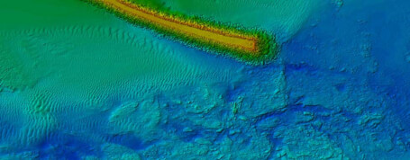
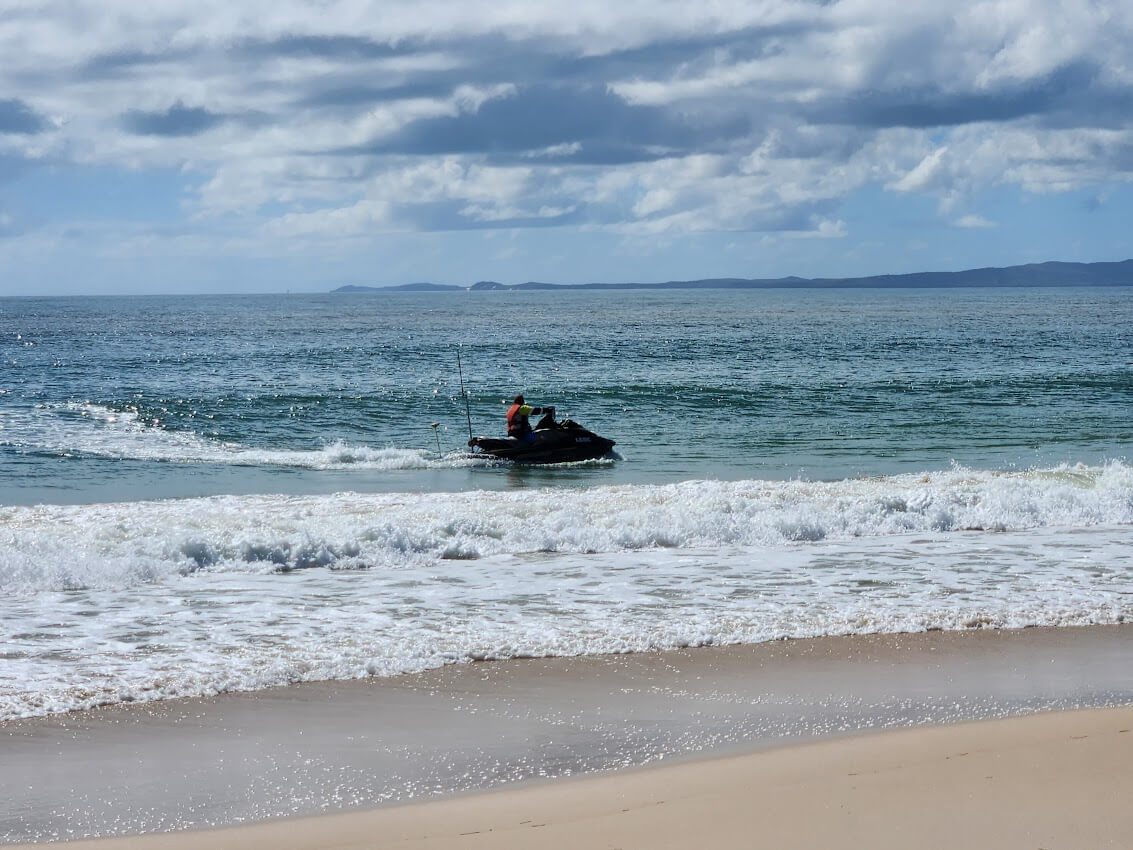
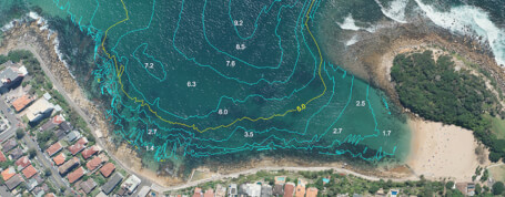
Three survey disciplined merged seamlessly. The Task Astute Surveying was charged with the task of surveying a breakwater and river channel situated on the Mid North Coast of NSW. The Plan The plan was to survey the underwater area with multibeam echo sounder technolog...
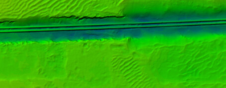
Multibeam Echo Sounders | Hydrographic Surveying | MBES Surveyors. Multibeam Echo Sounders (MBES) offer significant advancements in the technology of Hydrographic Surveying, making the applications for these systems virtually endless. MBES surveying is highly specialised an...
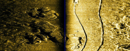
Sidescan Sonar Surveying | Side Scan Sonar Surveyors. Sidescan Sonar is used to locate and visually depict objects lying on the sea bed. It is typically used for search and recovery where the objects may have fallen off vessels, been dumped over the side or even the vessels...
Single Beam Echo Sounder Surveying | Single Beam Echo Sounder Surveyors. There are various scenarios where using a Single Beam Echo Sounder (SBES) either instead of, or in conjunction with, the Multibeam System, can have significant advantages. Single beam is suited to shal...
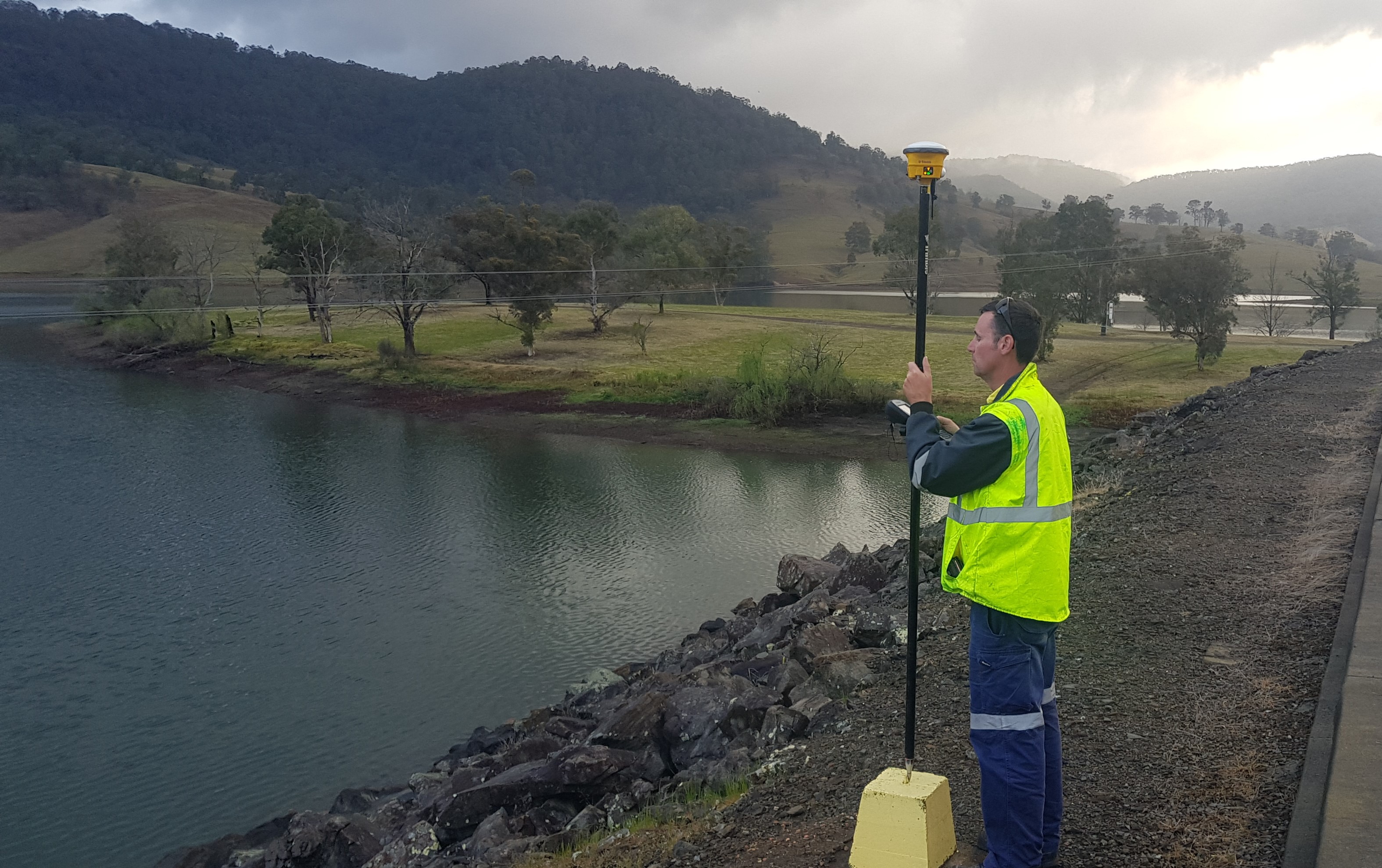
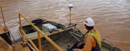
GNSS Surveying | GNSS Surveyors | Global Navigation Satellite System. Astute Surveying uses the latest GNSS (Global Navigation Satellite System) available. This system offers the benefit of receiving both GPS and GLONASS data combined and with the increasing number of satel...
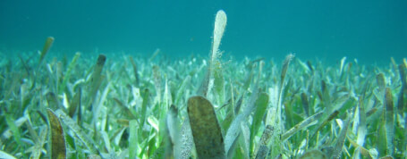
Sea Grass Mapping | Sea Grass Surveyors. Scientists and Environmentalists are very concerned with the health of Seagrasses as they play a vital role in our ecosystem. Using a combination of technologies we are able to not only locate the position of the sea grasses, we can...
Marine Geophysics Surveying | Marine Geophysical Surveyors. It is very important to know what is below the seabed before most projects (particularly construction and dredging) can commence. For example, determining the locations, areas and depths of hard rock could save sign...
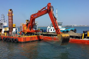
Dredging Surveyor | Trailer Suction Hopper Dredges | Back Hoe Dredges. Astute surveying has successfully supplied a range of services for several dredging projects in the past. We have extensive experience working with Trailer Suction Hopper Dredges (TSHD), Back Hoe Dredges ...
2026 © All Rights Reserved. Website by Cloud Concepts
