Astute Surveying Logo
  • Home
  • Services
  • Our Work
  • News
  • Equipment Hire
  • About Us
  • Contact Us

Equipment Hire


We have spent years investing in quality equipment that utilises the latest technology. If you have a particular project and need to contact us about hiring equipment listed below, reach out to us today for an estimate. 


HYDROGRAPHIC


Astute Surveying Hydrographic, GPS and Laser Surveying

R2Sonic 2022 Multibeam Echosounder

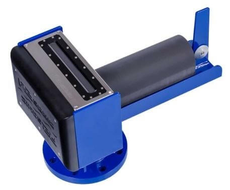
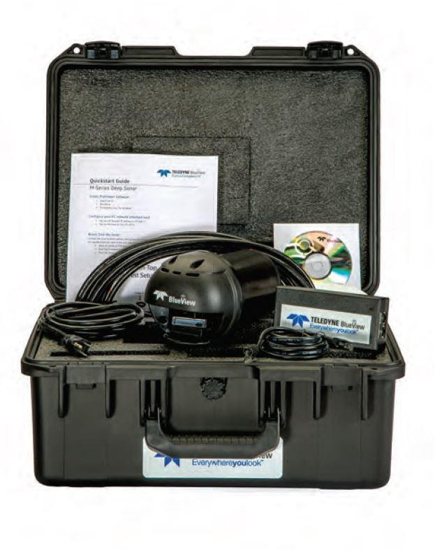
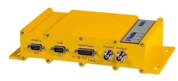
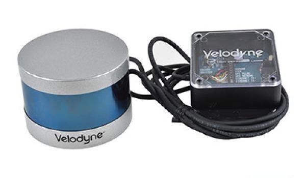
Small form factor multibeam sonar, ideal for remote vehicle and small boat operations, with a range of up to 400m+.

High level description:

  • Great resolution: 0.6⁰ x 0.6⁰ at 700kHz

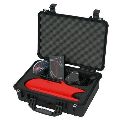
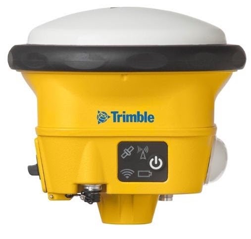
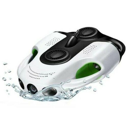
Highly portable: receiver

Astute Surveying Hydrographic, GPS and Laser Surveying

R2Sonic 2020 Multibeam Echosounder

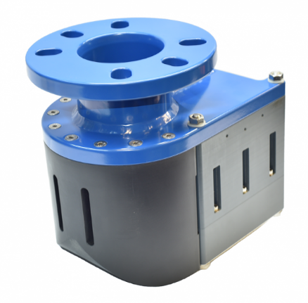
Highly portable, our entry level multibeam sonar is small, easy-to-use and offers remarkable performance for a competitive price. 

High level description:

  • Compact and light: 140 x 161 x 133.5 (mm), 4.4kg
  • Low power consumption: 20Wavg
  • Range: +200m

Astute Surveying Hydrographic, GPS and Laser Surveying

POS MV WaveMaster

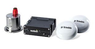
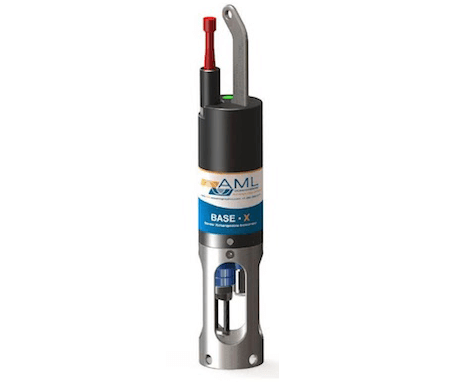
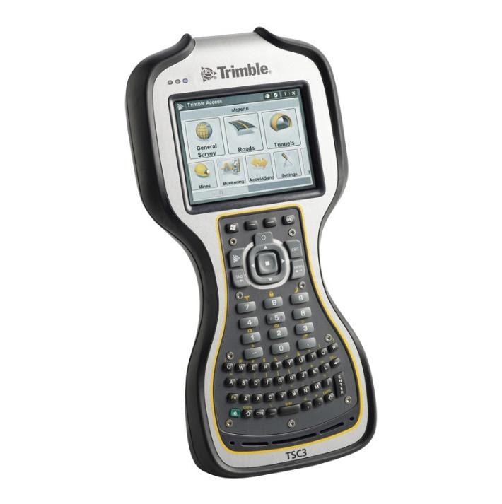
A user-friendly, turnkey system designed and built to provide accurate attitude, heading, heave, position, and velocity data of your marine vessel and onboard sensors. POS MV is proven in all conditions, and is the georeferencing and motion.

Astute Surveying Hydrographic, GPS and Laser Surveying

CEE ECHO™

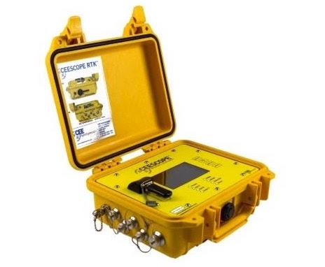
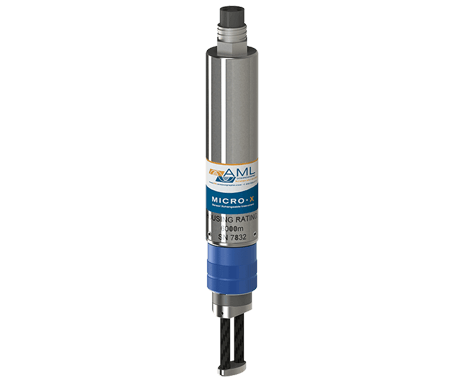
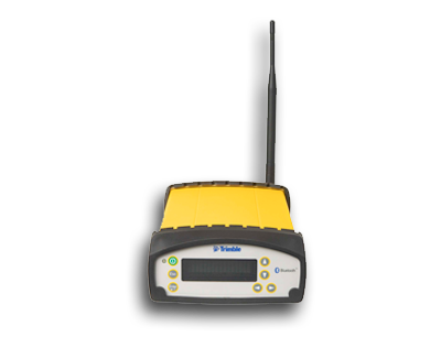
A state of the art portable echo sounder with advanced capabilities in a truly compact package. Internal data logging, full water column echogram and 20 Hz ping rate in a robust waterproof enclosure proves quality does not have to be sacrificed for convenience.

Astute Surveying Hydrographic, GPS and Laser Surveying

Edgetech 4125

  • Ultra high resolution imagery for easier identification of targets
  • Lightweight for one person deployment
  • Dual simultaneous frequencies
  • Choice of either a 400/900 kHz or 600/1600 kHz towfish
  • Standard heading, pitch, roll and depth sensors
  • Topside processor and laptop for open boat operations
  • Runs on AC or DC
  • Sets up in minutes and is easy to operate
  • Optional quick change tow bracket for hull inspections
  • System is supplied in rugged portable cases for easy transport

Astute Surveying Hydrographic, GPS and Laser Surveying

BlueView Imaging Sonar

The dual-frequency 900 kHz and 2250 kHz provide the most versatility of any 2D imaging sonar. The 900 kHz offers high resolution long range navigation, object detection, and obstacle avoidance, while the 2250 kHz provides ultra-high resolution at close range. ROV navigation, hull inspections, structure inspections, diver monitoring, and search and recovery are a few applications that benefit from the dual-frequency’s imaging capabilities.

Astute Surveying Hydrographic, GPS and Laser Surveying

Star Fish 900 Side Scan Sonar

990F system includes towfish with 20m cable, topside controller box, AC adapter, StarFish Scanline software, GPS receiver, pole mount bracket, and Pelican carrying case.

Features
  • 1MHz acoustic chirped pulses with a 0.3 degree beam width produces defined and clear images
  • Can easily be deployed and operated by a single person for real-time digital seafloor images
  • 'Plug and Play' system connects to any Windows-based PC or laptop via a USB connection
Astute Surveying Hydrographic, GPS and Laser Surveying

AML Sound Velocity Profiler x 2

Base•X is the smallest multi-sensor data logging instrument in the X•Series family. Its compact size makes it ideal for hand deployments from small boats, jetties, suitable shorelines, etc. As Base•X shares the same pedigree as larger, more featured instruments in the X•Series family, it provides the same capabilities, functionality, and accuracy, but in a condensed package.
Astute Surveying Hydrographic, GPS and Laser Surveying

AML SV for the multibeam head x 2

Real-Time Sound Velocity: Micro•X • Designed primarily for MBES, hull mounted applications, and vehicle integration • Pairs with Base•X2 or Minos•X to provide a total SV package • Cables compatible with all major multibeam systems available; custom configurations available on request.

Global Navigation Satellite System (GNSS)


Astute Surveying Hydrographic, GPS and Laser Surveying

Trimble SPS985

Combines unprecedented strength and durability into a compact form that is easy to use and virtually indestructible.
Astute Surveying Hydrographic, GPS and Laser Surveying

Trimble TSC3

The Trimble® TSC3 controller with Trimble Access™ software is a handheld field computing solution that streamlines the flow of everyday surveying work and the number of devices you need in the field.
Astute Surveying Hydrographic, GPS and Laser Surveying

Trimble SPS852 – Base & Rover

Whether you need a reliable GNSS base station or a rugged rover, the Trimble® SPS852 or the SPS855 GNSS Modular Receivers give you the flexibility to perform all of your construction site measurements. As a permanent or semi-permanent base station, they provide GNSS corrections for site measurements and machine control. As rover's, they can move easily from a site supervisor's truck to a pole mount for grade checking, site measurement and stakeout.
Astute Surveying Hydrographic, GPS and Laser Surveying

Trimble BX982 x 6

The Trimble BX982 GNSS receiver enclosure Is a multi-channel, multi-frequency OEM GNSS receiver that allows OEMs and system integrators to rapidly integrate centimeter-level positioning and precise heading into their applications. The Trimble BX982 supports GPS L1/L2/L5 and GLONASS L1/L2 signals.
Astute Surveying Hydrographic, GPS and Laser Surveying

RTK Radios

SATELLINE-EASy Pro is an IP67 classified UHF radio modem with a high power transmitter, a wide 70 MHz tuning range and selectable channel spacing. It is particularly well suited for outdoor use under varying weather conditions, e.g. land surveying. Due to the high transmitting power, connection distances of up to 80 kilometers can be covered.

Unmanned Aerial Vehicles (UAV)


Astute Surveying Hydrographic, GPS and Laser Surveying

Phantom 4 RTK

From the ground-up, revolutionizing its systems to achieve a new standard for drone accuracy – offering Phantom 4 RTK customers centimetre-accurate data while requiring fewer ground control points. With a built in-flight planning app (GS RTK) and an easy method to collect RTK data (RTK Network or D-RTK 2 Mobile Station), pilots have a full solution for any surveying, mapping or inspection workflow - right out of the box.
Astute Surveying Hydrographic, GPS and Laser Surveying

Phantom 4

The DJI Phantom 4 Pro+ V2.0 Drone not only excels at design, but also in technology. The sophisticated controller, which performs through a compatible radio transmitter, guarantees you an entirely comfortable piloting experience when flying the flying drone. The integrated obstacle detection feature will meanwhile check the areal terrain ahead of the camera to prevent the drone from getting damaged. Image stabilisation also balances out camera vibration at higher speeds. The exact positioning of the drone is guaranteed by the incorporated GPS. The drone weighs 1375 g and is suitable for personal use. Its operation is therefore not particularly limited by legislation, e.g. safe end-of-flight systems. The low weight makes it especially useful for filming walks in the country.
Astute Surveying Hydrographic, GPS and Laser Surveying

Phantom 3

  • Automatic video editor that helps you create a new movie in seconds
  • User-friendly interface for controlling the camera and flight settings
  • Live map and radar that tracks your Phantom 3 Standard as it flies
  • Full flight telemetry including current speed, altitude, and distance
  • Flight logs to record and remember your best moments
  • Fly for up to 25 minutes on a single charge

Laser Scanner


Astute Surveying Hydrographic, GPS and Laser Surveying

Velodyne “Puck” VLP16 Laser Scanner

Compact, Powerful, Intelligent
Velodyne’s Puck lidar sensor (previously VLP-16) is the highest-value sensor on the market. The Puck™’s reliability, power efficiency, and surround view make it the ideal solution for affordable low-speed autonomy and driver assistance applications.

Remotely operated Vehicle (ROV)


Astute Surveying Hydrographic, GPS and Laser Surveying

BW Space Pro - 4K Underwater Drone

Features
  • Camera - 4k UHD
  • Maximum Depth - 330FT
  • Auto-adjust Lighting
  • Depth Maintenance Shooting
  • 330 FT Dive
  • 5 Hours Battery Life
  • 9600mAh Battery 
  • Digital Defogging
  • Image Stabilizer
  • +45 degree adjustable tilt
  • Vertical movement
  • 1/1.7inch CMOS Clearer Underwater World

Vessels


Astute Surveying Hydrographic, GPS and Laser Surveying

6m Coastal Explorer

Astute Surveying Hydrographic, GPS and Laser Surveying

4.75m Puddle Jumper

Astute Surveying Hydrographic, GPS and Laser Surveying

12 Foot Tinie

Astute Surveying Hydrographic, GPS and Laser Surveying

Seadoo 155 Jet Ski

Astute Surveying Hydrographic, GPS and Laser Surveying

Kayak

Software


Astute Surveying Hydrographic, GPS and Laser Surveying

Hypack/Hysweep

Astute Surveying Hydrographic, GPS and Laser Surveying

PosPac Post processing Software

Astute Surveying Hydrographic, GPS and Laser Surveying

12D

Astute Surveying Hydrographic, GPS and Laser Surveying

Microstation

Reach out to us today for a quote and a deadline that works for you.


CONTACT US
Astute Surveying Hydrographic, GPS and Laser Surveying

Where to Next...

  • Home
  • Services
  • Our Work
  • News
  • Equipment Hire
  • About Us
  • Contact Us

Contact Us

  • Unit 5, 23/29 Trade Cct, Wauchope NSW 2446
  • 0422 44 10 17
  • [email protected]
  • LinkedIn
  • Facebook

Member of the Surveying & Spatial Sciences Institute and the Australasian Hydrographic Society

2025 © All Rights Reserved. Website by Cloud Concepts

Login


equipment-hire