Astute Surveying Logo
  • Home
  • Services
  • Our Work
  • News
  • Equipment Hire
  • About Us
  • Contact Us

Services

Aerial Drone Survey Services

UAV technology has revolutionised how aerial mapping and surveys are done today. Instead of relying on satellite imaging and expensive aircraft that can take weeks to mobilise, developers are turning to aerial drone survey services.
Aerial mapping and surveys are commonly used in various industries, including agriculture, construction, disaster management, environmental monitoring, dredging, reclamation, and much more. UAV drone building surveys are one of the most powerful tools in today’s construction and development.

UAV drone building surveys hold numerous benefits for the industry, including:

• Cost: Deploying a drone is much less expensive than more traditional options such as aircraft and satellite imaging.
• Time: Using a drone allows surveyors to cut down significantly on resource hours and groundwork. A drone can collect all the detailed measurements you need in a fraction of the time.
• Accuracy: Drones equipped with multiple cameras and sensors can collect highly accurate information, including topographical and 3D imaging for construction and development industries.

We use the latest technology in UAV drone building surveys, offering our customers a comprehensive range of accurate, cost-effective, and timeous surveying and mapping services. Contact us today to find out how we can help you.

Marine Construction and Dredging

Bathymetric survey is an essential factor in marine construction and dredging projects to assist in the understanding of the project requirements. It provides data on what specific and unexpected steps might need to be taken and allows for accurate deadlines to be set for the project.

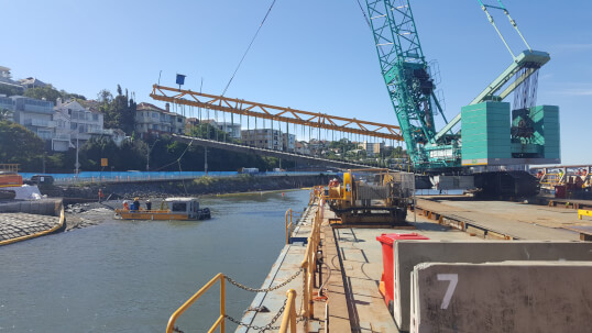
Pre dredge surveys assist in the planning phase of the project whist progress surveys are vital information for the efficiency of the works. Our experience includes working with Trailer Suction Hopper Dredges and Back-Hoe Dredges, as well as Ploughs. We provide all key personnel with timely and easy to interpret data by integrating GPS positioning on the vessels and real-time data uploads.

Astute Surveying Hydrographic, GPS and Laser Surveying
<br>


Specialist Services

  • Marine Geophysics - This includes seabed mapping to establish a clear picture of the materials and sediments below the seafloor. Locating where denser or more difficult materials are to assist with the planning for construction and dredging. This service is also vital for locating fuel lines, electricity cables, and communication cables embedded in the seafloor.
  • Laser and Drone Aerial Surveys - Not all terrain is easily accessible or surveyable by foot or boat. We use laser and drone aerial surveys when required allowing us to collect data on more challenging terrain. The latest Mobile Laser Scanning (MLS) technology enables vessels with a multibeam system to survey under bridges, along wharf faces, breakwaters and dam faces.
  • Equipment Hire - We have spent years investing in quality equipment that utilises the latest technology. If you have a particular project and need to contact us about hiring equipment, reach out to us today for an estimate.

Coastal Engineering Projects

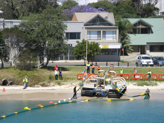
We also assist coastal engineers providing survey data for beaches, rivers, lakes, dams and estuaries. Using this data we can generate volumes, cross sections, 3D TIN models, contours, charts and reports in many formats.

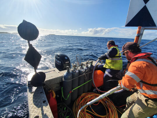
We utilise a range of vessels to navigate these waterways taking into consideration difficult access or sea conditions to achieve the results. 

Astute Surveying Hydrographic, GPS and Laser Surveying
<br>


Port and Harbor Surveys

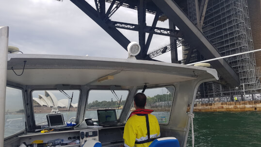
The main purpose of port and harbour surveys is to provide vessels with the information they need for safe navigation. The data provides ships with accurate depth measurements for the safe navigation according to the draft of the vessel. As the depths of channels and berths can change over time, regular survey is required. These surveys also detect hazards like large objects that have been dumped or fallen into the water, these need to be detected and removed as they pose a threat to vessel safety.

The information is provided to the Harbour Master of the port and promulgated in the hydrographic charts.

Contact us today for a quote for your next project.


CONTACT US
Astute Surveying Hydrographic, GPS and Laser Surveying

Where to Next...

  • Home
  • Services
  • Our Work
  • News
  • Equipment Hire
  • About Us
  • Contact Us

Contact Us

  • Unit 5, 23/29 Trade Cct, Wauchope NSW 2446
  • 0422 44 10 17
  • [email protected]
  • LinkedIn
  • Facebook

Member of the Surveying & Spatial Sciences Institute and the Australasian Hydrographic Society

2025 © All Rights Reserved. Website by Cloud Concepts

Login


services